Gazetteer Project information
- Course: Coding Traineeship - IT Career Switch
- Category: Web Development
- Project date: July 2021
- Project URL: https://robertgrady.co.uk/project1/
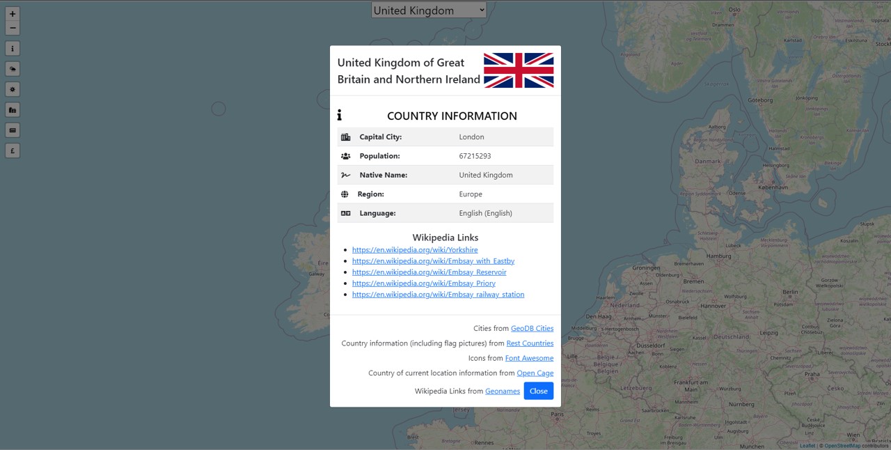
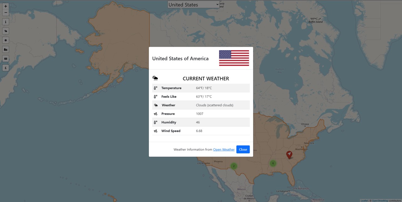
The specification was to reply to a website specification for a map-based app to provide information on countries – with a focus on a “mobile-first” development. Preferably using a framework, to then develop HTML, CSS and JavaScript with JQuery modules that use PHP server-based components to source data from third-party APIs (Geonames, OpenWeather). The solution is assessed on its delivery to specification, functionality, and usability.
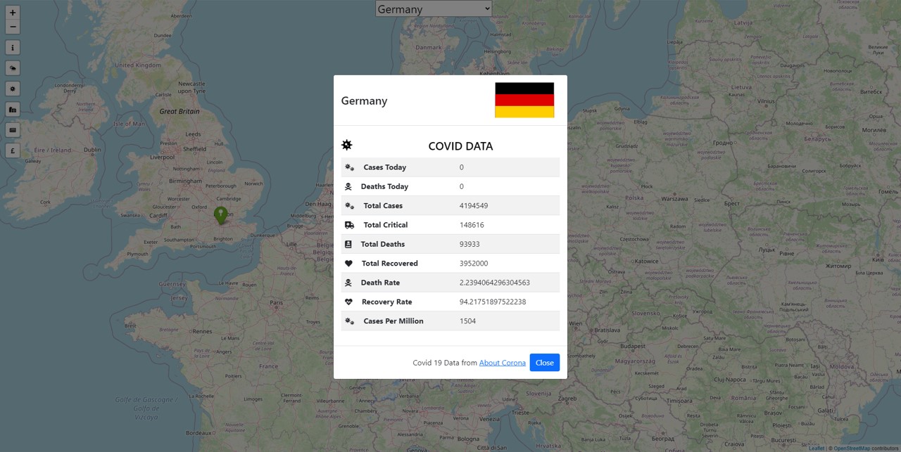
All data mentioned in the images are correct at time of image being taken. All country data mentioned in the images comes from their respective owners
RECENT UPDATE: This project use to incorporate a Covid based API providing covid related information on countries. The API used (About Covid) no longer exists and since such information is no longer necessary has been removed from the project. But for interest the third picture shows what it use to provide when it was around.